


Lake Navigation GPS – Are They That Good?
After reading our reviews, you are definitely aware that boat GPS navigation systems are considered a must by many boat-owners and virtually all fisherman. They offer so many features, they come in so many sizes and models. The lake gps unit you choose really comes down to your personal situation and how you plan to benefit from having a lake navigation GPS system on board.
We felt you may find it helpful if we sorted out all the advantages and disadvantages of using a marine Chartplotter for your vessel – to remind you that all types have the same general application in the open seas. Moreover, with guiding electronic devices in the sea you will be faced with identical challenges, so we hope this helps you in your decision on which lake navigation system will work, best for you. Let me say, if you are in doubt, just go with the Garmin EchoMAP Chirp.
Benefits
- You can quickly and easily find and store your favorite waypoints.
- Get detailed maps of any water surface in the world, including lakes, rivers, and channels, and install them in your device via an SD card.
- Connect your chart plotter to your phone to get the advantage of more high-tech features.
- Can plot the shortest and safest course based on your vessel’s specifications.
- Fish Finder features to aid your fishing activities.
- It can show relevant information on the screen like water temperature, air temperature, speed, and depth.
- May come with radars, transducers, and sonar to help you with the fishing.
- Ability to show a side view and down imaging.
- Designed to be water-resistant, durable and light.
Drawbacks
- Some models do not come with SD slot cards.
- All detailed maps, except for the basic in-built one, should be purchased.
- There are limited mounting options, especially if your boat’s dashboard is curved. Also, the quality of the material may not come to your expectations.
- Sometimes your preferred language is not listed in the language menu settings.
- If you are using a network Chartplotter, there might be a time lag between what your device is showing you and what you actually see in front of your boat.
Lake Navigation GPS Unit The Types and What
You Really Need To Know

Unless you are a compass navigation pro, then you definitely need a Chartplotter to help you navigate in the open sea and on large lakes. But what about GPS devices make them so useful and helpful? Well, imagine you have only a GPS system in your boat – you will see the coordinates of the place you want to go, but they will be shown in numbers. s
And if you have skipped Geography classes like I did, the latitude and longitude coordinates will not be familiar to you at all. So, here comes the pivotal role of the Chartplotter. This unit is an excellent combination of a GPS system and an optical device through which you can actually see where you are positioned on the map shown on the chart plotter’s screen.
You can no longer be lost in numbers or coordinates because they are going to be accurately plotted on your device so that you can easily read them and go boating with confidence.
However, chartplotters come in different types, and this is perhaps what will make you feel confused when considering investing in one. For this reason, our team has compiled a list with the basic models that you may come across on the market as well as their main features and characteristics. And remember that the more advanced the technology is, the bigger the investment will be, such is the case for sailing electronics.
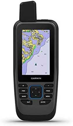
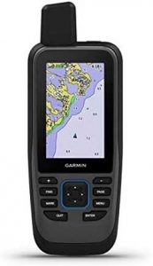
1. Handheld Chartplotters
This type of device for marine navigation has the option to be placed anywhere, and as their name states, you can hold them in your hand. They come with internal GPS and are small in size which makes them very compact to use while sailing or doing most any water sports. Handheld Chartplotter has all the essential functions which will be enough for you to determine your position on the map and mark your waypoints. In addition, these units are equipped with integrated maps although not that detailed as some wish for.
Still, all handheld chart plotters’ manufacturers offer a wide variety of lake or sea maps to be downloaded or can be bought separately as an add-on to your unit. And one more thing – since the screen of such products is small, you need to pick a handheld Chartplotter with very bright colors and screen protection from direct sunlight.
2. GPS Marine Chartplotters
The second type is also basically like the handhelds, but the difference is that its screen is bigger than the handheld GPS units. Some try, but in general you will not find it very comfortable to hold it or mount it on your kayak, so such guiding navigation is more suitable for bigger boats and not intended for water sports. However, GPS Marine sailing electronics may come with so many features such as additional maps, options to save waypoints and routes, a barometric altimeter and a built-in compass. In short, this is all you need for a weekend of boating.
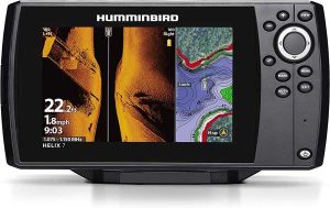
3. GPS Chartplotter With Built-in Fish Finder
Now, this is what every fisherman would like to have in their boats and one of the reason they have gained so much popularity over the years. If you want to take your family out on the lake fishing, what is the number one goal? Of course, catch fish, and this is what these type of lake navigation devices are designed to help you do.
This type of device has the same characteristics as the basic GPS Chartplotter, but there is a built-in fish finder. You will definitely like this extra since it sends sound waves into the subsurface and then turns the signal into a picture to be shown on the screen of your chart plotter. This way you will easily find the perfect fishing spot without wasting your time, boat fuel, and families patience.
Another thing is that you can upgrade such steering navigation with a sounder when you buy an additional antenna for the weather or radar. Also, some models come with a transducer, but if this is not the case with your chosen model, you can always purchase such separately.
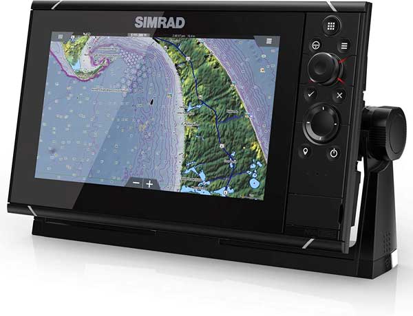
4. Network Chartplotters
As the name suggests, this is a high-tech navigation device designed to provide you with the most accurate information of the sea bottom as well as give you full control of your boat. Usually, network chart plotters have built-in internet connectivity so that you can use your marina’s Wi-Fi or tether it to your smartphone. This way you will get not only an accurate picture of your target location for your route, but importantly, be alerted of possible dangers under the water & floating debris. The operation systems of network chart plotters are exclusively user-friendly and very advanced, so you will really like all the extras it has to offer like controlling your boat motors, water temperature feature, free Cloud services and even listening to music.
5. Network Chartplotters With Built-in Fish Finder
These types of marine navigation systems are again aimed to support fishermen, but since it is cutting-edge technology, you will undoubtedly enjoy the 2-dimensional image of the sea bottom on the screen. This way, your fishing trips will become even more productive & enjoyable.
What To Look For When Shopping for Lake GPS Unit
In this section, we are going to list some of the features that may come with your Chartplotter or be purchased separately to boost your navigation device’s performance. We have included some basic information on each one’s purpose and functions as well. This way, you will no longer hesitate what the most useful features for you and your boating activities is.
1. Transducer
Some marine chart plotters are sold with a transducer while others are not. But in either situation, you need to know why a transducer is so important and what type you need.
Transducers actually serve as an antenna for your boat sonar’s system. The electrical signal that comes from the sonar is turned into a high-frequency sound which is then sent into the water’s subsurface and when it reaches the bottom or any other object like rocks, for example, the signal returns. At this very moment, the transducer receives the incoming signal and turns into a frequency that can be read by the sonar. And this is how you get the image of what is under your boat are displayed on the screen.
The transducers that come with chart plotters will be efficient because you will not waste your time and money in searching for any additional devices. Also, this tool for converting electrical signals will help you when you go fishing & provide more safety when boating in unknown waters.
2. Chirp Sonar
This feature is excellent for giving you an accurate image of the sea bottom in terms of depth and resolution. And thanks to the fact that this type of sonar transmits and receives signals in more than one frequency, you can quickly distinguish between big fish from small schools of fish, for instance.
Also, if your marine Chartplotter is equipped with Chirp sonar, then the chances of you receiving misleading information from the sea bottom are minimal. The reason for this is the ability of the sonar to tell the difference between true sonar echo and common disturbances.
In addition, there are different frequency ranges for the Chirp sonar that can be exceptionally functional depending on where you do your boating. This is crucial when you want to cast your anchor successfully. So, do not miss out on our best boat anchors thorough guide along with our top picks to help you choose the right device for mooring your vessel.
UNDERSTANDING GPS CHIRP FREQUENCY
· Low Chirp Frequency
Here the signal is transmitted at 25-80 kHz or 50 kHz, which means that such signal will be excellent for sailing in really deep waters – more than 196 feet.
· Medium CHIRP Frequency
When the frequency is between 80-160 kHz or 83 kHz, then you can easily find great fishing spots in shallow waters.
· High CHIRP Frequency
At high frequency like 160-800 kHz or 200 kHz, you will definitely get the highest resolution. Moreover, if your vessel is sailing fast, the high chirp frequency will be able to show you whether there is fish or other objects under the water. Also, such a frequency range is most suitable for water depths of up to 196 feet.
3. Maps
No matter whether you are boating in the ocean or fishing in a lake, it is just smart to know your exact whereabouts. This is why maps are of great importance, and all chart plotters come with preloaded ones. Today you can easily find maps for most all lakes in the United States, Canada and most parts of the world.
So, when picking a marine Chartplotter, make sure to get all the details about the preloaded maps and all the charts that do not come in the package.
4. Lake GPS Mounting Hardware
Although not a feature of the chart plotters’ electronic characteristics, positioning your device the right and safe way is vital. We advise you to check your boat’s dashboard and think how to mount the Chartplotter since some vessels ‘panels with controls are not conventional.
Also, make sure to research the material of the mounting bracket. If plastic is mainly used, then you will have to buy a new product for securing your Chartplotter as this material is not durable at all.
5. Screen Brightness Display
When choosing your perfect device for marine navigation, do not forget to check whether there is protection against direct sunlight. It is also essential to pick a product with extremely bright color options to get a clear view of the images on your sailing electronic device regardless of the weather conditions.
Marine Chartplotter Installation Tips
Installing your device is a pretty straight forward simple project. They are basically installed the same way. This video will give you a good general understanding.
Here we will give you a step-by-step guide to installing a basic model navigating device.
- Choose the place where you will mount the Chartplotter and make sure it will fit. Sometimes this is a challenge, especially when you have to consider the protection of the device as well as the viewing angles.
- After deciding on the most appropriate place, drill the 4 holes for the mounting studs. You should make a hole in each corner to match the device’s chassis.
- Run the cables for the chart plotter before you actually position it.
- Then you have to reach in behind to fix the thumb nuts to secure the unit.
- Place the helm panel and after that turn on the device for testing.
- Insert the chart data card (if you have such), and your Chartplotter is ready to navigate.
Finally, do not forget to read the manufacturer’s installation guide for more specific details on your marine steering device.
Maintaining Your Lake Fishfinder
All devices needs proper care, and the same goes for lake fishfinders. And given the fact that you may use this device in any kind of weather conditions and in a variety of situations, you need to know how to keep it safe. So, here are some important tips about maintaining your fishfinder.
1. Screen
Taking care of the visible parts is a must. And the screen is the most important here. Make sure that:
- You clean it with a soft cloth or we have found that a PC screen cleaner works best.
- Make certain the back of the chart plotter is sealed against the pod; otherwise, the device will not be water-resistant.
- You do not use abrasive or solvent-based cleaners on the device.
2. Software Updates
Updating your marine navigating device is essential because it can give you the latest information about the weather, currents, tides and many more. Make sure to call a technician or contact the manufacturer if any problems occur when the image is blurred on the screen, for example. Most software updates are accomplished quickly and easily much like cell phone updates.
3. Replacing instruments
Sometimes you will need to make some changes to your Chartplotter device either due to upgrades or any troubleshooting features. In these situations, it is crucial to take into consideration the following tips.
- In case your display has been cracked, or your transducer is not working, and you have to replace them, remember to contact the same device’s manufacturers replacement parts. If you cannot find a replacement for your Chartplotter model because your navigation system type is no longer in stores, then you still have some options. A properly maintained device can provide you service for years.
If the part that you need is a stand-alone instrument and it is not connected to any network, then it is going to be easy fix.
If the part is networked with others, then you will have to check whether your device is equipped with a standard NMEA output. (most today are). Remember that your new instrument must use the same protocol to make it work but make sure you get some extra cables, just in case. Also, a data combiner will be a great idea since some NMEA protocols have a limit to the number of instruments available.
Marine Chartplotter Safety Tips
Buying and installing your electronic navigation system is just the beginning of your boating adventure. But if you are not aware of the possible dangers or do not know how to work with your Chartplotter, then any voyage could turn into a nightmare. This is the reason why we have prepared some essential safety tips to ensure boating pleasure.
- Navigation systems are essential, but they are made to assist you, so do not rely only on your Chartplotter. You really need to have some basic navigation knowledge and know your boat. Much like a GPS in your car. When my daughter first started to learn how to drive, I did not allow here to use a phone app to tell her every turn she needed to make to get to her grand moms house. I wanted her to first develop a sense of basic navigation. I think this is a critical thinking skill that we should all try to develop. Some of you will remember vacations and the days of paper maps bought at the gas station. 🙂
- If you are going to use a map that is on an SD card, make sure that the map is up-to-date. This way you will have the latest information about all the possible dangers that you may encounter.
- It is vital to study and understand all the symbols that you will see on your device’s screen. They can very slightly from device to device, but a few minutes of concentrated study is really all you will need.
- When plotting your course remember to check what is standing between you and your destination because your Chartplotter will show you the shortest way but not the hazards you may come across on your journey.
- Make sure you plan your route carefully and understand where exactly you are going. You can get an excellent helper when looking at what is in front of your vessel in the far distance if you have binoculars which should be part of your boating carry on tools. So, do not forget to invest in a good pair of marine binoculars
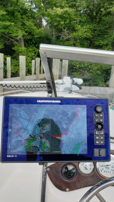
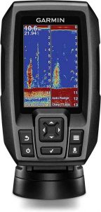
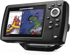
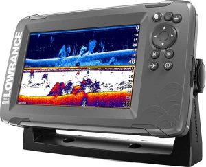
Best Marine GPS Chartplotters Comparison Chart
Wrap Up
This is the end of our guide but surely the beginning of your safe boating adventures. We hope this helped you decided which device makes the most sense for your and your personal boating situation.
| PRODUCT | PRICE | DIMENSIONS | WEIGHT | MAXIMUM DEPTH | DISPLAY SIZE |
|---|---|---|---|---|---|
|
|
$ | 3.9x 6.9 x 1.8″ | 8.1 pounds | 1,600 feet freshwater, 750 feet saltwater | 3.5″ |
|
|
$$ | 15.75 x 4.75 x 9.63″ | 3.26 pounds | 1200 feet (3,000ft with optional 50kHz) | 5″ |
|
|
$$$ | 10.1 x 8.4 x 7.75″ | 8.4 pounds | 200+ feet | 5 , 7, 9″ |
|
|
$$$ | 11.4 x 6.5 x 2.4″ | 2.3 pounds | 800 ft for salt – up to 1000 ft for freshwater | 9″ |
|
|
$$ | 10.54 x 5.8 x 3.68 (mount size) | 3.6 Pounds | 1200ft (3,500 with optional 50 kHz) | 7″ |
|
Garmin GPSMAP 78sc Handheld GPS
|
$$ | 1.7 x 2.65 x 7″ | 9.6 ounces | N/A | 3″ |
Simrad NSS Evo3 |
$$$$$ | 18 x 10 x 6″ | 8.4 pounds | 9″ |

If this guide helped you with your choice, don’t forget to share it with your lake friends or online. Thanks for reading and as always – enjoy every day!6.9